My Own Version of Map of Arica
|
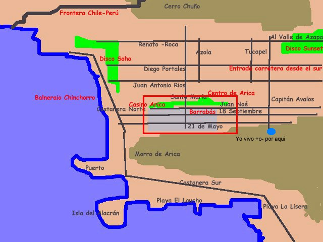
Ok, I know is a little rough but is good enough to locate the main points in downtown. The red square marks the "downtown of the downton" the corner of 21 de Mayo and Colon St. is the epicenter of our city. The main interest point are both "costaneras" (coast roads), from Rio Lluta at north trqugh Las Machas and Chinchorro beaches, the Disco Soho, the Port, the "Isla del Alacrán" and el Laucho and La Lisera beaches, ending at Playa Corazones in the south extreme of the city (down) My home is at an heigth from a side of el Morro de Arica near 21 de Mayo Street. If someone of you wanna visit me Ok, will be wellcomed, except at lunch hours wahaha In the nigth the move is at both costaneras, between disco Soho, the Casino and the Isla del Alacrán. In direction east-west we have the Bar Barrabas, the BAr The End and the disco Sunset at Valle de Azapa. |
Some maps a little better
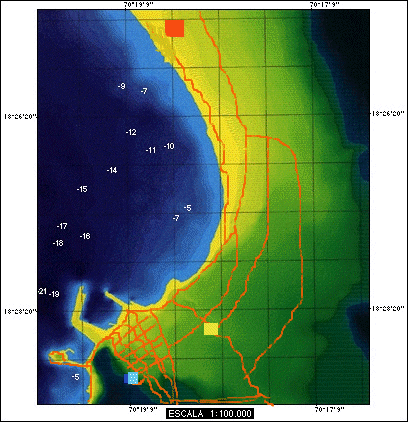 |
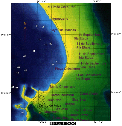
The black shadow (down rigth)
correspond to the Morro, the red square is the airport "Chacalluta",
the yellow square is the road transport station and the ligth blue is my
home
Down the seashore (down to top) there are the Playa la Lisera, El Laucho, Isla del Alacrán, the chilean port, the peruvian port and the great bend of Latinamerica (the same you see in the map!) with Chinchorro and Las Machas beaches. a little higher there is the airport and the border Chile-Perú. The main street of downtown (paralel to sea) are: Costanera Sur, Costanera Norte wich ends at Rio Lluta estuary (top near the sea). Paralel to thart is Avenida Santa Maria wich meets Costanera Sur and then start the Carretera Panamericana to Perú (Ruta 5). More innerland is Avenida Azolas and Avenida Capitán Avalos both also meet with the Carretera Panamericana. Reaching Arica by road from south of Chile you enter for a road paralel to Valle de Azapa |
|
|
Downtown There are several streets and I only name the main ones: paralel to the sea from the coast are Prat, Colón, Baquedano, Lynch, General Lagos, Blanco Encalada, Gallo. Crossing perpendiculary to the coast from el Morro (left) are: 21 de Mayo, !8 de Septiembre, Maipú, Ohiggins, Chacabuco and Juan Noé. This is the so-called "el centro" (downtown) |
 |
The Neighbor Villages The main neighborhood are "el centro" or "casco viejo" (downtown) Magisterio and Saucache (prosperous). the "poblaciones" San José, Tucapel, Juan Noé, Campo Verde y las 5 etapas de la "11 de Septiembre" hoy rebautizada como "Cardenal Silva Henriquez" moderatly modest and the "poblaciones" Cerro Chuño y Cabo Aroca (poor). Anyway those clasifications are not strict nd is not unusual to see good houses in modest neighbors and vice versa |
And Two Air Pics...
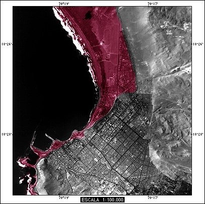 |
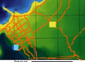
Arica at a birds eye, the red zone
correspond to the probable reach of sea in case of tsunami (we are
waiting for the big one since 140 years).
The pic shows the most of the city and their neighbors |
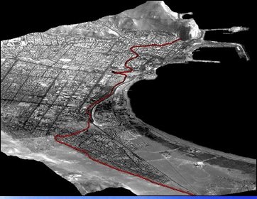 |
This pic is shot at less heigth and in a more horizontal perspective from north to south. In the top it can sees clearly the Morro de Arica and the port |