 The Map of Chile
The Map of Chile
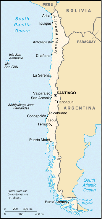
In this image you can see the map of Chile and the location of Arica, just in the north border with Perú and Bolivia.
To give you an idea of distances Arica and Iquique are 300 Km away, the distance between Arica and Santiago is 2050 Km and Arica to Puerto Montt are 3078 Km.
Our country is very long and if you plan to travel over 500 Km I reccomend you take a plane, fares are reasonable and service aboard is excellent. The only inconvenient are the high taxes in airport (in Peru are still higher). The main airlines in Chile are Lan Chile and Ladeco, both are merged recently so your tickets are fully interchangeable. There are Avant airlines which is pretty good also.
If you are travel in a budget, the most wise is arriving to Santiago by plane and then go north via bus. Bus service is good, but due the long distances I reccomend you trip making stops. By example Santiago - La Serena - Caldera (not appears in map, is very small but nice) - Antofagasta - San Pedro de Atacama - Arica.
If you want see a road map of the Región de Tarapacá (in which Arica are) click here